From Barcelona
Discover the unknown France by bike
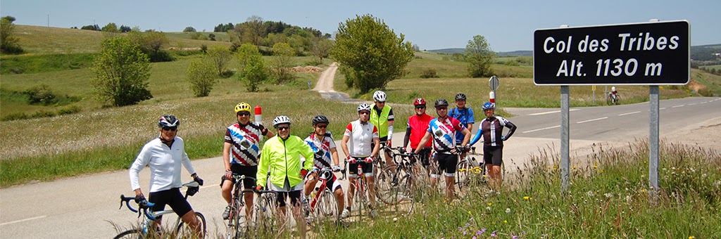
Bike ROUTE: Les Cevennes
Les Cevennes in France is an ideal place for a cycling destination. It has routes that awaken the senses with varied landscapes. It’s a warm climate, lacking in extreme temperatures, allowing you to enjoy the sport throughout all the year. Dare to discover the secrets of Les Cevennes by pedaling.

Discovering the entire Cévennes’s National Park is a great experience, only available for the most experienced bikers. Important note: in some stages may require logistical support such as energy food, mechanical repairs and body massage to recover in order to complete it. All this service is exquisitely supplied by Making Tracks Travel.
In almost all the tourist resorts such as Ales, Florac, St Jean du Gard park, there are hotels for you to regain strength. Here we describe three stages.


Summary Stage:
 Date Saturday June 7 06/18/2014
Start Time 10:110
Distance: 83,986 km / 57.15 mi
Total time 5:00:30
Average speed: 11.4 mph
Elevation 4,229 C ::
Temperature: 77.8 º F
Second stage: Florac - Saint Jean du Gard. The intricate road network that runs through the volcanic mountains of Aigoual (1567m) and Lozère (1699m) are an ideal place to enjoy the road bike stage. The highest point, Mount Aiguoal, is a natural spot to view the Natural Park Les Cevennes. It is considered one of the best places to practice this sport. On Sunday, June 8, 2014 at 9h04 am in Florac we took the D907 road towards Racoules and Vébron. Through Frayssinet Fourques we went to the Coll Perjuret. At the 25 km mark, where we found the first supplies, we went to Coll Fourques, reaching the mythical Mont Aigoual (1567 m high). It makes us remember how in 1987 Silvano contini past through Mont Aigoual. There were spectacular views of the natural park as we continue to drop, thousand meters, to our supply point. Then a tough afternoon over the port Prat Peyrot “Coll” of 1226m and 1512m Serreyre. We continued down the road D986 through the L'Esperou and Valleraugue villages, to arrive at the Coll Pas at 75 km. Then we went down Les Plantiers, and L'Estrechure, Saumane. In total it was a mythical 100 km stage, finally making it to Saint Jean du Gard on the road D907. The end stage, we arrived in time to see the victory of Rafa at Roland Garros. We were thankful for the massages, dinner and rest.

Time: 5:42:43
Average speed: 11.5 mph
Elevation: 1853m / 5,518 ft
Calories: 4,747 C
Temperature: 81.7 ° F
Third stage: St Jean du Gard - Saint Guilhem le Désert. This step runs througout medieval remains such as La salle, Colognac, Notre Dame London to Saint Guilhem le Desert. It's a tumbleweed route we did at a good pace with a couple of stops. Coll Bantarde and Saint Hippolyte du Fort, that despite being mini stages, were though. Les Cèvennes don’t make it easy for you. The arrival in Saint Guilhem le Désert on the day of the Pentacost celebration, we discovered one of the most beautiful villages in France, overflowing with joy and festivity. The end of this lovely bike ride is an interesting medieval world of humanity by UNESCO located in the path of Camino de Santiago (The Way). There the Gellone Abadia was declared a historical monument in 1840. We visited it in detail after a shower and a hearty meal. It was a trip to remember.
Summary Stage:
 Distance 63.6 km
Time: 3h 31:49
Average speed: 13.1 mph
Elevation: 3,009 ft
Calories: 3,322 C
Temperature: 80.5 º F


No hay comentarios:
Publicar un comentario